
AI Hurricane Forecasts: What an Extra Day Buys You
AI hurricane forecasts beat physics models on Hurricane Isaias. See what an extra day of warning means for the forecast cone and when your family should act.
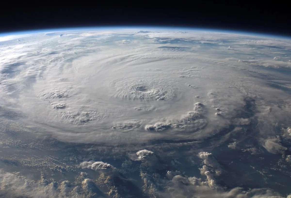
Table of contents
Picture the week before Hurricane Isaias. You live on the Gulf Coast, and the big physics models keep pulling the storm west, toward Louisiana or Mississippi. You relax a little, and then it comes ashore near Destin, Florida, as a Category 2. One forecast tool had called that stretch of coast days earlier, and it was not a traditional model.
AI hurricane forecasts moved from experiment to everyday tool this season. Google DeepMind's model beat the conventional guidance on the path of Isaias, the first hurricane of the Atlantic season, and forecasters now fold it into the official track you see on TV. That matters if you ever have to decide when to board up, book a room inland, or leave.
This guide covers what the AI models actually improved, where they still fall short, and how to turn an extra day of warning into better choices for your family.
What AI Hurricane Forecasts Got Right This Season
Isaias was the test case. According to NPR's report on AI hurricane forecasting, conventional models first sent the storm toward southeastern Louisiana. The Google DeepMind model correctly pointed at the western Florida Panhandle. The New York Times described the same split, with physics models leaning west and the AI models pushing east toward Pensacola.
NPR reported that the storm hit near Destin in early October as a Category 2 hurricane. The traditional models drifted toward the AI answer as landfall approached. By then, though, the AI had been on the right coast for days.
Forecasters are not shy about it. Meteorologist Michael Lowry told NPR the DeepMind model has been "by far and away, the best performing computer model that we've ever seen. Period." Brian McNoldy of the University of Miami said it "came out of the gate in first place" when the National Hurricane Center (NHC) began using it in its official forecasts last season.
How an AI Weather Model Predicts a Storm
Traditional forecasts start from physics. They take readings of temperature, humidity, pressure and wind from satellites and aircraft, then solve equations about how the air will move. That takes huge supercomputers and hours of run time.
The AI approach is different. It is a form of machine learning that studies thousands of past storms and learns the patterns that tend to come next. Google DeepMind says its cyclone model trained on nearly 20 terabytes of global weather data plus a database of almost 5,000 historical storms. It can produce a 15-day forecast in under a minute on one of Google's chips.
Speed is the real advantage for forecasters. Because each run is cheap, the model can explore many possible futures at once. Google says it now generates 1,000 scenarios per storm, up from 50 last year. More scenarios give a clearer picture of which paths are likely and which are long shots.
If you want the bigger idea behind models that learn how the physical world behaves from data, our piece on world models and AI that learns physics first covers it. Hurricane models are one of the clearest real-world payoffs of that approach.
The Numbers: Roughly One Extra Day of Warning
The headline claim comes from a paper Google DeepMind published in Nature in August. On its WeatherNext research page, the company says the model delivers about one extra day of predictive accuracy on track, intensity and wind structure. Put simply, its three-day forecasts are as good as what earlier models gave at two days.
The five-day figures are the striking ones. According to The Decoder's summary of the Nature paper, the model's average track error at five days was about 230 kilometers, or roughly 143 miles. The leading European ensemble missed by 370 kilometers, and Google's own earlier AI model by 335 kilometers.
- Track error at five days: 230 km for the new model versus 370 km for the European ensemble.
- Intensity at three days: 3.75 knots more accurate than NOAA's HAFS hurricane model, per The Decoder's summary of the paper.
- Scale of the jump: Google calls it roughly a decade of progress, judged against trends over the last 20 years.
Keep one thing in mind. Those are Google's results on Google's model, tested on past storms from 2023 onward. The independent check is this season's real-world record, and so far it has held up on track.
What the Forecast Cone Means for Your Decisions
The tool you actually see is the NHC forecast cone. According to the National Hurricane Center's season update, each circle in the cone is sized so that two-thirds of official forecast errors from the previous five years fall inside it. This season, the Atlantic cone is about 4% to 8% smaller than last year's.
Here are the Atlantic circle radii the NHC is using this season, converted to everyday miles:
- 2 days out (48 hours): 62 nautical miles, about 71 miles.
- 3 days out (72 hours): 95 nautical miles, about 109 miles.
- 4 days out (96 hours): 134 nautical miles, about 154 miles.
- 5 days out (120 hours): 200 nautical miles, about 230 miles.
A worked example: how much an extra day narrows your risk
Say a storm is four days from landfall. Today's cone puts the center somewhere within about 154 miles either side of the track. That is a strip of coast roughly 308 miles wide where landfall is plausible.
Now apply Google's one-day claim as an illustration. If a four-day forecast became as reliable as today's three-day one, the radius would drop to about 109 miles. The strip shrinks to roughly 219 miles wide, about 29% narrower. Many towns that would sit inside the cone four days out would fall outside it.
For a family, that is the difference between two choices. You could book an inland hotel and take time off on Tuesday for a storm that misses you. Or you could wait a day and decide with a much tighter picture. Treat this as a rough guide: the cone is built from the NHC's own blended forecasts, not from any single model, so it will only shrink as fast as the official errors fall.
Where AI Models Still Fall Short
The catch is intensity. NPR reported that the DeepMind model led on the path of Isaias but did not match the NHC's blended forecast on strength. Jamie Rhome, the center's deputy director, told The New York Times that AI shows promise on intensity and storm structure but does not yet match traditional methods.
That gap matters because strength drives your risk as much as path. A storm that jumps from Category 1 to Category 3 overnight changes surge, wind damage and evacuation zones. Rapid strengthening is the hardest case of all, and it is where every model, AI or not, still misses most.
Two more limits apply:
- Nobody can fully explain the answers. "We don't know why they might get a forecast right," Lowry told NPR. That makes forecasters cautious about leaning on a model when it disagrees with everything else.
- Bad data in still means a bad forecast out. The Times noted that Google's earlier model missed Hurricane Otis in 2023, as did the physics models. Otis formed where few weather sensors exist, and every model depends on those starting readings.
This is why the NHC blends sources. Rhome told the Times the consensus of models plus human judgment often beats any single model. NHC Director Michael Brennan told NPR that intensity errors are now about half what they were at the time of Hurricane Katrina.
How to Use Better Forecasts Before the Next Storm
The better model is already inside the official forecast. You do not need a special app. What you need is a plan that uses the extra warning instead of wasting it.
- Follow the NHC, not a raw model map. Google's own page tells readers to rely on their national weather service for warnings. A single model run shared online can look dramatic and change completely on the next run.
- Decide your trigger days now. Write down what you will do at five days, three days and two days out. At five days, check supplies and prescriptions. At three days, book a refundable room. At two days, leave if your zone is called.
- Remember the cone covers the center only. The NHC says the cone represents the probable track of the storm's center. Wind, rain and surge can reach well outside it.
- Check your coverage early. If you have a trip near the coast, read the storm rules in your policy before a system gets a name. Our guide to when travel insurance pays and when it won't explains the common exclusions.
Watch intensity forecasts with extra care. If the outlook says a storm could strengthen quickly, plan for the higher category even when the track looks settled.
Frequently Asked Questions
Are AI hurricane forecasts more accurate than traditional models?
On track, yes, based on this season and last. Google DeepMind's model beat conventional guidance on the path of Hurricane Isaias, and forecasters quoted by NPR call it the best performing model they have seen. On intensity, traditional methods and the NHC's blended forecast still hold an edge.
Does the National Hurricane Center use AI models?
Yes. The NHC began using Google DeepMind's model in its official forecasts last season. Forecasters combine it with several other AI and physics-based models, then apply their own judgment before issuing the cone and warnings.
Why did the hurricane cone get smaller?
The cone is sized from the NHC's actual forecast errors over the previous five years. As those errors fell, the circles shrank. This season the Atlantic cone is about 4% to 8% smaller than last year's.
Can I see the Google AI hurricane forecast myself?
Google publishes cyclone forecasts on its Weather Lab site and has released the model's code and weights for researchers. For decisions about your safety, use the official NHC forecast and your local emergency managers, which already factor in the AI guidance.
An Extra Day Only Helps If You Use It
AI hurricane forecasts have earned their place. Isaias showed a model calling the right coast while the physics models pointed elsewhere, and Google's research claims about a day of extra accuracy. The NHC cone is already a little tighter than last year's.
None of that removes the hardest part, which is how strong a storm gets and how fast. So set your trigger days now, follow the official cone, and treat a tighter track as more time to act, not a reason to wait.
Written by
Nora Whitfield
Technology & AI
Covers the technology beat for Quick Trend Insights, with a focus on what new AI tools and consumer hardware actually change for the people using them.
Related Articles
View all
AI Chatbot Copyright: When Gemini Rewrites the News
AI chatbot copyright: an EU court adviser says Gemini can infringe news publishers when it reuses their wording. What the test means for answers and sites.

AI Personalized Pricing: Is Your Price Set Just for You?
AI personalized pricing can show you a higher price than the next shopper. What the FTC asked Delta, Uber and Walmart, and how to check your own price.
In-Space Assembly: Why a Robot Building in Orbit Matters
In-space assembly had its first real test: a Caltech robot built part of an antenna in orbit alone. Here is why size limits matter for your phone and more.